
Stop yelling at your meteorologist: Here’s why storms are so hard to track
- Ric Kearbey
- Feb 11
- 3 min read
It’s a three-day weekend, plans are made, and the forecast keeps changing its mind. Here’s why that huge cross-country storm is so frustratingly hard to nail down — and why it’s not anyone’s fault.
The setup: a cross-country storm bringing rain, drama and very mixed signals. This is why storms are hard to track
A big weather system is crossing the U.S. right now, loaded with Gulf moisture.
Southeast: Finally getting rain in drought-stricken areas — but some spots could see flash flooding if heavy bands train over the same place.
Midwest: Catching the southern edge — likely heavy rain in places, but not everywhere.
Northeast: Marginal cold air means mostly rain, though a slight track shift could bring a little snow or ice to some areas.
The pattern is classic late-winter mess. And during a holiday weekend, the uncertainty feels extra personal.
Thunderstorms: tiny, sneaky jerks that ruin plans and laugh at forecasters
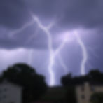
Thunderstorms are small and short-lived — often just 5–15 miles wide and gone in under an hour.
Weather models use giant grid boxes (10+ km wide). That’s like trying to spot individual fireflies in a dark stadium using a satellite photo.
They need tiny triggers to explode:
a random seabreeze collision
an old outflow boundary
a pocket of extra afternoon heat
None of these show up reliably in big models until the storms are already happening on radar.
Chaos is the real problem: why tiny differences create huge forecast swings

The atmosphere is mathematically chaotic.
Tiny errors in our starting observations grow bigger the farther we look into the future. It's a big reason why storms are hard to track.
Examples of small things that matter:
a 1-degree temperature difference
a 5-knot wind shift somewhere upstream
These can move the whole storm track hundreds of miles by the weekend. That’s why the 6 a.m. model run and the 6 p.m. run sometimes look like different storms.
The track wobble love triangle: one small change and everyone’s weekend flips
This system has multiple low centers and a wobbly jet stream.
A small shift in the track completely changes the outcome:
Stays south → heaviest rain & flood risk focused in the Deep South / Southeast
Slides north → more rain (maybe some snow/ice) toward the Mid-Atlantic & Northeast
Midwest sits in the middle: soaking in some places, barely wet in others
One little wobble = huge difference in who gets flooded vs. who stays dry.
Weekend play-by-play: pop-ups on Friday, soakers on Saturday, who-knows on Sunday
Friday: Scattered pop-up thunderstorms. Hard to say exactly where or when.
Saturday: Broader rain shield + embedded heavy storms. Training bands could drop 3–5+ inches in spots → real flash flood risk.
Sunday: Still wet for many, but heaviest rain likely shifting east. Exact timing and location still uncertain.
Short-range models and radar sharpen the picture every 6–12 hours — confidence jumps as we get closer.
Nerd comfort blanket: why “we don’t know yet” is the honest answer

A 60% chance of rain isn’t hedging. It’s the truth.
Ensemble forecasts (dozens of slightly different model runs) often look like a giant bowl of spaghetti. When the lines cluster together → high confidence. When they stay spread out → we stay cautious.
Best news: Inside 12–24 hours, high-resolution models and live radar see the real storms forming. That’s when forecasts get much more accurate.
So yes — the forecast will keep changing. Yes — it’s frustrating. But your local meteorologist isn’t lying or trying to ruin your weekend. They’re just wrestling with an atmosphere that refuses to follow a script.
Keep refreshing radar when it gets close. Leave the umbrella in the car. And maybe give the forecast team a little grace — they’re fighting chaos every single day.